Global Land Alliance GIS Collaboration
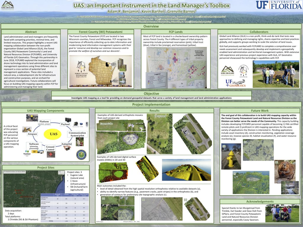
The following poster was presented at the GIS Expo in South Florida in August 2018. It presents the outcome of a collaboration between Global Land Alliance (GLA), the Forest County Potawatomi Community’s Land and Natural Resources Division (FCPLNRD), and University of Florida (UF) Geomatics Program. The group conducted a technical exchange to better understand the potential of Unmanned Aerial Systems (UAS) technology in assessing and managing Forest County Potawatomi community land, natural resources and infrastructure.