Participatory Village Boundary Setting and Resource Mapping in Indonesia
By Dhyana Paramita, Akhmad Safik, Rubeta Andriani, Kevin Barthel
Maps of administrative boundaries are important tools for governments and citizen as they directly impact allocations of social services and control of natural resources. In Indonesia, many local governments are working to establish village boundaries for the first time. Determining and officially setting more than 75,000 village boundaries is both a significant challenge to the national and district governments throughout Indonesia and provides an important village-level base for the broader implementation of the Government of Indonesia’s eagerly awaited One Map. There have been many community mapping and village boundary setting exercises in Indonesia. Some take a strictly governmental and technical approach to achieve surveying and mapping requirements, while others focus on ensuring community participation and societal acceptance.
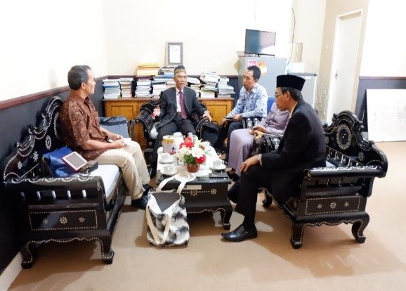
Over the years, the challenge has been finding an effective balance to achieve both government authorization and community legitimacy. In October 2018, a team from Global Land Alliance visited the districts of Lombok Tengah and Pesisir Selatan, Indonesia to discuss their experience with implementing the ‘Participatory Village Boundary Setting and Resource Mapping (VBS/RM)’ methodology.
Village Boundary Setting and Resource Mapping:
a participatory approach to determining administrative village boundaries, which complies with Indonesian Government regulations and integrates international best practices of community mapping using modern surveying and mapping technology combined with the mapping of significant natural and cultural resource areas within the villages.
Lombok Tengah in West Nusa Tenggara and Pesisir Selatan in West Sumatra were part of a pioneering Participatory VBS/RM effort of the Millennium Challenge Account-Indonesia to develop and test a ‘community-up’ approach to defining and setting village boundaries and identifying and mapping significant cultural and natural resources within the villages. VBS/RM was part of a broader goal of building local capacity for managing land and natural resources through the Millennium Challenge Corporation funded Green Prosperity Project, Participatory Land Use Planning (PLUP) Activity[1]. At the conclusion of the PLUP in April 2018, local officials, administrators and villagers expressed interest in expanding the implementation of VBS/RM and sought initial assistance in technical and operational aspects and budget planning.

In response, Global Land Alliance deployed a multi- disciplinary team (lawyer, sociologist and land use planner) of Indonesian experts to complete a review with local officials and villagers to learn more about the impacts and operational details of VBS/RM implementation and to support initial planning for its expansion throughout the districts.
Lombok Tengah initially conducted Participatory VBS/RM in early 2018 and completed the process in eighteen villages. Two important results were (1) the approval of district government regulations (Peraturan Bupati/Perbups) that officialized the VBS/RM methodology in the District and (2) the preparation and approval of official Village Boundary Maps. The maps, prepared in accordance with the regulations, legally codify the results of the VBS/RM process and the maps were formally registered in the village registry of the Government of Indonesia’s Ministry of Home Affairs. Prior to VBS/RM, governmental jurisdiction had been difficult to determine when implementing development projects and providing public services. After VBS/RM, the districts have up-to-date, accurate and community-accepted geospatial data and officially recognized village base maps that are both included as a layer in the Indonesia One Map, and which the district government will use to update the District Spatial Plan (land use plan). The local Village Empowerment Agency highlighted that VBS/RM has made their work easier, more transparent and accountable as it allows linking funding allocations from the national government to villages with geographically referenced boundaries. District officials reported that they are eager to continue VBS/RM in other subdistricts throughout the district.
“VBS/RM has significantly benefited the district not only by providing the official maps but also settlement of many village boundary segments that have been disputed since many years ago.” –First Assistant of the District, Lombok Tengah
Beyond the government benefits, VBS/RM has provided benefits to villagers. These include: (i) long- absent clarity on official jurisdiction and elected representation, (ii) resolution of historical land use and ownership disputes, (iii) better understanding on where to apply for land use and natural resource licenses and permits, (iv) official acceptance of local toponymy and the identification, and (v) geographic referencing and accurate mapping of natural and cultural resource features including sacred and importance physical features and landmarks, birth places and tombs of historic individuals that play a role in local legend. In fact, villages not included in the MCA-Indonesia PLUP Activity are now pressuring local officials to complete participatory VBS/RM using local government resources.

Pesisir Selatan is unique in the context of VBS/RM as it saw the most expedited and ambitious implementation of the methodology in Indonesia during early 2018. During a three-month period, 40 villages located in two sub-districts were completed using the VBS/RM process. The Secretary for Koto XI Tarusan sub-district reported that prior to VBS/ RM the historical and on-going situation of unclear boundaries created dilemmas for his office on issues of granting licenses and permits for land and natural resources uses and for authorizing land deeds. If a village administrator could not issue these types of documents due to unclear village boundaries and in-turn jurisdictional authority, in many cases villagers seeking official documents would go to another village official who was willing to provide the documentation. Because of this all-to-common practice, a parcel of land or license could have multiple administrative authorizations issued by different villages –causing a situation of uncertainty and ineffective management of land and resources which has both governance and social implications, especially at the local level.
Officials in Pesisir Selatan reiterated benefits resulting from VBS/RM, in particular in simplifying budgeting and allocating funds for development investments and to manage disputes over control of favorable geographic locations. In the past there had been many discrepancies and disputes among villages related to financial allocations by the district governments and regarding control of favorable locations for tourist attractions, natural and cultural resource areas and highly productive lands. Lack of jurisdictional clarity led to disputes as many villages wanted to claim local control over these areas.
VBS/RM has assisted in defining clear and codified boundaries, providing local authorities and villagers with the geographic information needed to effectively manage land and natural resources.
The feedback from local officials underscores the wide-ranging benefits of mutually-agreed-upon and officialized village boundaries and mapping of significant village-managed resources. Through a process of participatory determination delineating and demarcating of village boundaries and recognition and mapping of natural and cultural resource areas, Participatory VBS/RM has shown how using participatory approaches to link government authority and community legitimacy can be effective in resolving village boundary disputes peacefully and provide acceptance and wide ranging governmental and community benefits. Global Land Alliance will continue to work with the officials and villagers of Lombok Tengah, Pesisir Selatan and other local governments and community groups interested in building on the MCA-Indonesia initiative and expanding VBS/RM throughout the country.
Those in Indonesia, or elsewhere, interested in learning more or applying VBS/RM, the following resources provide technical guidelines for the participatory mapping VBS/RM activity
Global Land Alliance is working with its Indonesian partners to support communities and villages in completing VBS/RM. If you are interested in learning more or funding these efforts, please reach out to
Christen Corcoran at ccorcoran@landallianceinc.org
[1] Learn more here: http://www.mca-indonesia.go.id/en/home