UAV Technical Demonstration with Forest County Potawatomi

Global Land Alliance (GLA), in collaboration with professors from the University of Florida’s Geomatics Department and the Forest County Potawatomi Community Land Information Department, conducted a hands-on, technical demonstration in northern Wisconsin this past June, 2018; exchanging ideas on the potential benefits of utilizing Unmanned Aircraft Systems (UAS) in assessing the Community’s natural resources and physical infrastructure.

Faced with competing interests and uses of the land and natural resources, the Forest County Potawatomi recognize the importance of efficiently collecting up-to-date information and modernizing land information management systems with their goal to ‘conserve and develop our common resources and to promote the welfare of ourselves and our descents’. The purpose of the technical exchange was to look at the use of UAV (drone) technology to quickly image and map Community resources ‘where and when needed’.


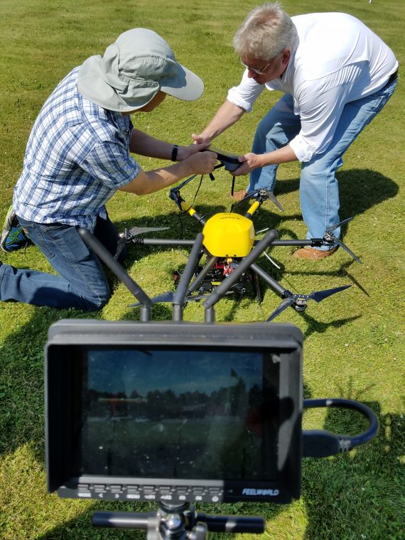
During the exercise, a GLA team spent three days testing a drone and software donated by Trimble. Kevin Barthel, Grenville Barnes and Adam Benjamin tested the ZX5 quadcopter drone in three different environments in Forest County, WI: a small 17 acre farm; a gas station and convenience store; and a rural area comprising forest, a water body and an old hayfield. All test sites were flown with both the ZX5 and a DJI Phantom drone at heights varying from 40 to 100 meters above ground. All ground control was targeted and surveyed by local land surveyors working for the Potawatomi community.
Over the first two days the GLA team captured almost 1400 overlapping photos covering an area of 65 acres. The third day was spent processing and preparing a presentation of the results. The drone images were used to produce digital elevation models (DEMs), orthophotos and 3-D point clouds of the three sites. The results were presented to natural resource managers responsible for managing land belonging to the Potawatomi native American tribe. Moving forward, GLA looks to help the Forest County Potawatomi assess their needs for including an UAS approach in addressing their territorial and infrastructure asset management, help them decide on the best UAV platform and sensors for their work, provide operation and technical training and assist them in being certified to pilot the drone.
