Property Rights and Global Development in Focus at New America Drone Summit
(BY MALCOLM CHILDRESS)
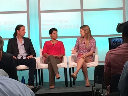
On July 22, Land Alliance played a central role in the New America Foundation’s “summit meeting” on drones: Drones and Aerial Observation: New Technologies for Property Rights, Human Rights and Global Development.
Our hats tip to the New America Foundation and The Omidyar Network for making the event a mash-up of participants from different parts of the drone scene. The New America Foundation distributed a newly released primer on the wider application of drones for property rights, human rights and global development, offering a detailed and readable guide to a huge range of use cases and issues.
Janina Mera joined experts representing US regulators, the aerospace and drone industry, citizen scientists and environmental activists, disaster relief providers, peacemakers with the UN system, and a strong contingent of journalists.
Here are three key takeaways from the event.
1: Land Alliance is among the leaders for utilizing UAS for parcel mapping in the developing world. Janina presented Land Alliance’s pilot activity of participatory e-formalization in Peru using UAS. Land Alliance’s activity is among a handful of new demonstrations of the promise (and the issues) in the application of UAS for parcel mapping and empowering community involvement. Walter Volkmann’s (Micro Aerial Systems) pilot parcel mapping activities in Namibia and Albania are in the same category and show the way for establishing production parameters for cadastral mapping with UAS.
UAS for parcel mapping are cheap, fast and lend themselves to community participation. But limited battery life, the need for accurate ground control and image processing capability mean that UAV/drones complement, but don’t replace, traditional surveying.
2: The commercial UAS era is about to dawn in a big way and nobody is fully prepared for it. Darryl Jenkins’ (American Aviation Institute) presentation on commercial drones clarified that they change the economics of flight in big, scalable ways.
The technology is already good enough to make Amazon’s vast plans for package delivery into a feasible business proposition that has the potential to affect many industries. As battery capacity and sense-and-detect capabilities get better, the technological constraints will disappear for small UAS to deliver small packages at a massive scale. It was also interesting to learn that larger UAS are coming soon for high altitude.
The market is not psychologically prepared for the roboticization of transport, or for constant panoptic surveillance, but it seems all these trends are gaining momentum and we have to maximize the benefits while driving out the risks. The event participants focused more on safety and less on privacy, making a lot of good points about how insurance will likely drive standards and certifications, and the need for automated air traffic control in the low-altitude space to be developed and spliced into the air traffic control system. (By the way, the industry people essentially gave the ok to use the terms “UAS” and “drones” interchangeably in informal use).
3: There is huge development and activist potential to harness from drones. The same cost efficiencies and scalability that works for industry works for all the other uses too. The disaster-response community came off as being the most organized and sophisticated of the development users. Drones are already an standard part of their tool kit and their agendas have already evolved to higher level issues like coordinating data sharing, artificial intelligence and crowd-sourcing of image analysis, and logistical coordination with military and civilian air traffic (“it’s so great when you just go for one exemption for everybody!”).
Patrick Meier of Humanitarian UAV Network (and author of the book Digital Humanitarians) was an inspiration. I’ve long been a believer that the cadastral mapping community ought to take some lessons (and some software) from the disaster relief folks, and that was reinforced. Exciting experiences in this area are proliferating:
Digital Democracy is flying citizen inspections of pipelines in Ecuador making the aircraft with indigenous villagers. I loved the citizen science people and the DIY environmental monitors, but they seemed to be mostly early adopters who are still experimenting and figuring out how to use imagery, real-time monitoring and change-detection to win court cases, hold polluters accountable and help land management.
Public Labs is doing amazing things like photographing landfills from kites and balloons and making community maps of everything. In fact, their low-tech kite-mapping as demonstrated in Peru for a community “catastro” looks like one of the most scalable and cost-effective of all the UAS systems on display.
Peace-keeping in DRC got mixed reviews as a tool of observation for the UN-force there (hard to detect the actual combatants with thermal sensors under tree canopy when they stash their weapons, but helps with route-finding and incident-response). There is huge room for growth for the development and activist community using drones and kites and balloons, but those communities need help to get the technology cheap, easy and accessible, and understand how to use it, while staying nimble and lightly regulated.
Land Alliance is spearheading conversations to realize the potential of UAS for improvement in mapping for property rights and monitoring land use. The world is moving into the drone era and we all have to become responsible stakeholders to realize their potential for good.